September 2, 2024, 3:58 pm | Read time: 5 minutes
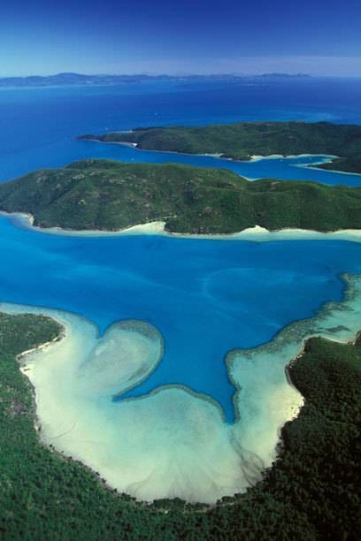
Almost everyone has seen a photo of the famous Whitsunday Islands in Australia. Now, there is an opportunity to explore the paradise islands in the footsteps of their first inhabitants. The Ngaro Sea Trail takes hikers and kayakers to the Ngaro cave paintings and quarries. And to fantastic viewpoints.
Were it not for the fence and signs guarding the cave on the Whitsunday island, one might mistake the red drawings on the rock face for the work of moderately skilled young graffiti artists. But they are ancient cultural treasures.
Probably 2000 years ago, an Aboriginal man from the Ngaro people crouched in the cave, dipped his fingers in ochre powder, and drew lines across the rock. Centuries ago, the Ngaro had to leave the Whitsunday Islands, and a new path now follows in their footsteps.
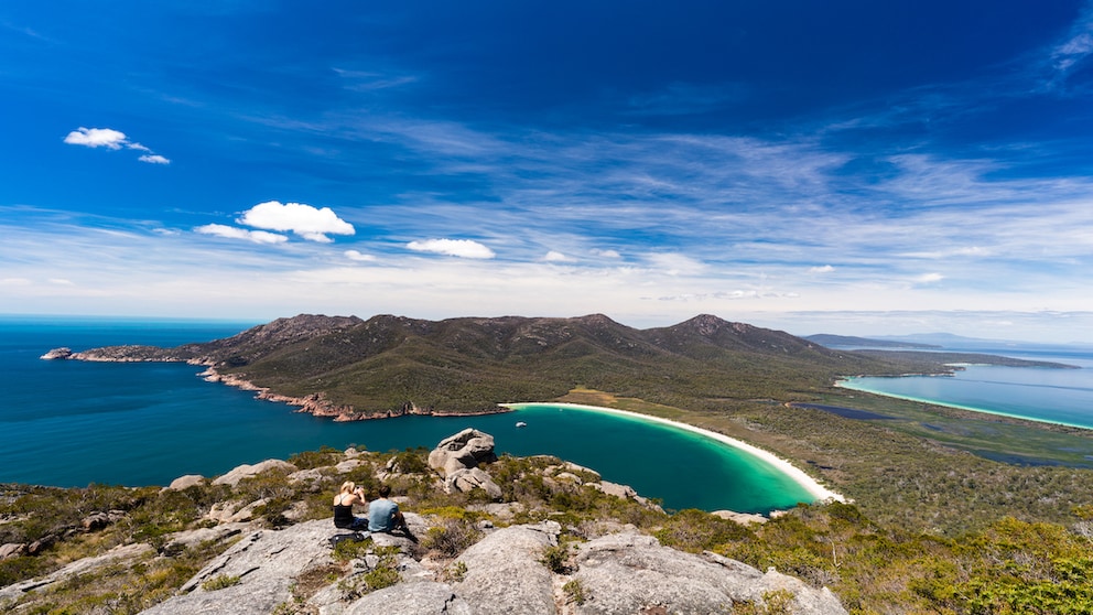
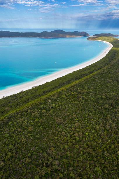
The Whitsundays are an essential stop on any journey along Australia’s east coast. Photos of the white sandy beaches are popular motifs on Facebook, Pinterest, and Instagram, partly because they look like the epitome of a beach paradise.
On the paths of the indigenous people
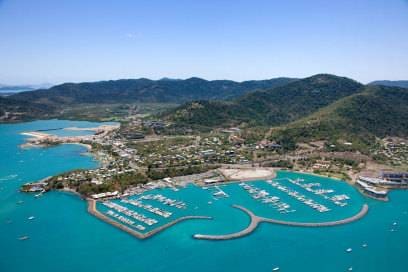
A fleet of sailing boats ferries backpackers and other holidaymakers around the islands for a few days. Airlie Beach, the usual starting point, is infamous for its boisterous party scene and somewhat questionable reputation. Yet, few tourists are aware of the archipelago’s original inhabitants.
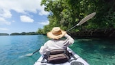
The Ngaro Sea Trail seeks to change that. “The trail leads to the peaks of the islands and to important cultural and historical sites,” says Damien Head, Director of National Parks in the Great Barrier Reef region. Rather than a single long-distance hiking path, it’s a network of kayak routes and hiking trails.
One of the shortest but most interesting trails starts at Nara Inlet, a deep bay on Hook Island. It leads uphill through dry bush from the shore to the cave with the rock paintings. Along the way, steles tell the story of the life and history of the extraordinary Aboriginal people, who once paddled from island to island in canoes made of tree bark.
At least 9,000 years ago, the Ngaro made landfall on the islands, the peaks of a submerged mountain range. At first, they were only here occasionally to forage for food. When they had learned new techniques and the sea level continued to rise, they stayed. They collected yams and Burdekin plums, mangrove crabs, and mussels. They fished with nets and fishing hooks made from turtle shells.
The revenge of the Europeans was merciless
Nara Inlet was the scene of one of several sad and bloody chapters in the history of European colonization of Australia. Many Ngaro warriors were rounded up and killed here. The survivors were deported to mission stations. Many were later forced to work as divers on pearl farms in the Torres Strait. This was the end of a bloody conflict between the Aborigines and the conquerors.
It began on June 3, 1770, when James Cook dropped anchor off the islands. It was Whit Sunday, or Whitsunday in English. Cook later said the Ngaro were the largest Aborigines he had ever seen. In any case, they were among the most unruly. Time and again, they climbed onto anchored ships at night to sabotage them or massacre the crew. The Europeans’ revenge was merciless.
Hikes on deserted islands
Many of today’s visitors, set ashore by sailboats in the adjacent bay and trekking to the Hill Inlet viewpoint, are unaware they’re traversing the Ngaro Sea Trail. “Most of those who choose to do the trail are kayakers,” says Damien Head.
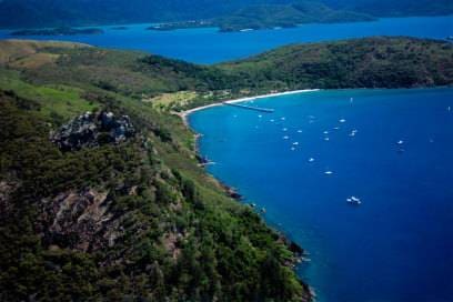
This also has its advantages. As a hiker, you often have an island to yourself. Or at least almost. On this day, a mountain biker boarded the water cab to South Molle Island. From Shute Harbour, the sturdy steel boat makes the brief ten-minute voyage before its landing ramp descends onto the sandy beach. The longest section of the Ngaro Sea Trail runs on land on the island. And the only one on which cyclists are allowed to ride.
One arm of the trail leads through an almost tropical forest to a rock that balances over the slope and to Lamond Hill. Lamond Hill is named after Henry Lamond, who grazed his sheep on South Molle until 1927. He then swapped the island for the dairy farm of Ernie Bauer, who built the resort. Atop the hill, a metal plaque stands in tribute to Lamond’s wife, Eileen, and their son, Hal. “They both loved this island” is engraved on it. It’s easy to understand why.

With the kayak Adventures in the Benagil Cave in the Algarve
Rediscover the Sunshine State 11 tips for advanced travelers visiting Florida
Simply fantastic! The most beautiful beaches: 11 we’d like to be at right now
Information about the Ngaro Sea Trail
How to get there: Several airlines fly from Germany to Brisbane. From there, there are domestic flights to Proserpine (Whitsunday Coast Airport), which is close to Airlie Beach. Alternatively, you can also fly to Hamilton Island. Ferries run between the Whitsunday Islands several times a day. Water cabs run from Shute Harbour, a suburb of Airlie Beach, to South Molle Island. Passengers must order the cab in advance and arrange when and where they would like to be picked up.
Travel time: The best time for hiking is the Australian winter and Autumn, i.e., between April and September. Temperatures during the day are between 21 and 26 degrees. In summer, it can get very hot, and cyclones regularly sweep over the islands. The rainy season lasts from January to April. September is the best time for kayaking when it is rarely windy.
Accommodation: Airlie Beach has everything from backpacker hostels to five-star hotels. The vacation apartments and hotels on the islands are generally more expensive. However, there are also campsites on many islands. Some offer tables, toilets, and water; others are just cleared areas. If you want to camp, you need a permit. You can apply for this at the visitor center, national park offices, or online.